NSW Farmers has warmly welcomed Daryl Quinlivan as the state's first Agriculture Commissioner with CEO…
NSW storms and floods information
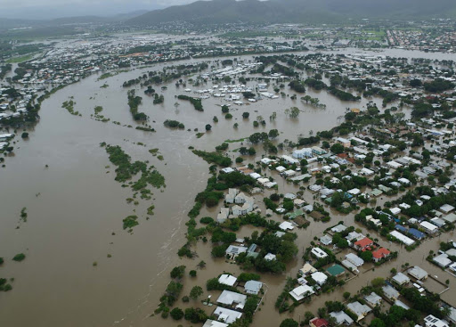
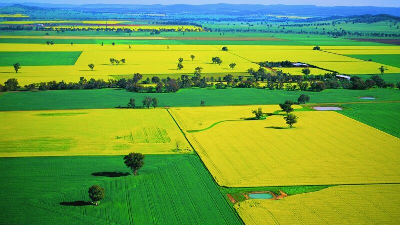
The weekend’s one-in-a-hundred year flood on the mid north coast has had catastrophic impacts with countless numbers of livestock lost, along with crop losses, pasture damage and infrastructure destruction.
To help with the emergency, NSW Farmers has put together the below contacts and updates for those requiring assistance.
Emergency Contact
The NSW Department of Primary Industries and Local Land Services NSW are providing assistance to landholders and communities with animal welfare-related issues resulting from the floods.
For more information visit https://www.dpi.nsw.gov.au/climate-and-emergencies/floods or phone the Agricultural and Animal Services Hotline on 1800 814 647.
Or call the LLS on 1300 795 299 for emergency support in managing livestock or flood impacts.
Australian Government support payments activated for NSW storms and floods
- Quickest and easiest way to claim is to call 180 22 66.
- Phone line is open now, eligible recipients can claim today.
- Check eligibility at www.servicesaustralia.gov.au/disaster
- Services Australia Mobile Service Centre and Mobile Service Teams mobilised to provide assistance when safe.
The Australian Government has activated the Australian Government Disaster Recovery Payment (AGDRP) and Disaster Recovery Allowance (DRA) to support those heavily affected by the storms and flooding in New South Wales.
Support through the AGDRP and DRA is now available in the local government areas of Armidale, Bellingen, Blue Mountains, Camden, Campbelltown, Canterbury Bankstown, Central Coast, Cessnock City, Clarence Valley, Coffs Harbour City, Cumberland, Dungog, Fairfield, Hawkesbury, Hornsby, Inner West, Kempsey, Ku-ring-gai, Lake Macquarie, Liverpool, Maitland City, Mid-Coast, Nambucca Valley, Newcastle City, Northern Beaches, Parramatta, Penrith, Port Macquarie-Hastings, Port Stephens, Sutherland, Tenterfield Blacktown, The Hills and Wollondilly.
More local government areas will be added following further assessments in consultation with the NSW Government.
NSW Government contacts during storms and floods
- Up-to-date information on transport disruptions, check travel alerts at transportnsw.info
- The latest road closure information and real-time traffic conditions, check livetraffic.com
- State Emergency Service updates including evacuation orders go to https://www.ses.nsw.gov.au/
- Bureau of Meteorology weather updates go to http://www.bom.gov.au/nsw/forecasts/sydney.shtml
Bureau of Meteorology
Widespread rain and thunderstorms will spread from NW WA through central and eastern Australia from the later part of the weekend into next week. That system will also bring Severe Weather and flooding concerns. QLD Flood warnings and watch continuing through South West with renewed risk from Sunday.
Western New South Wales
Severe thunderstorms are expected across the western slopes and plains as well as in the northeast. Heavy rainfall and flash flooding is a concern with any thunderstorm, however the risk is greatest about the Riverina and Central West where there is also the slight risk of damaging winds.
A rain band associated with a trough currently extends from northwest Western Australia through central Australia, and is moving east. Western areas of NSW are likely to see rainfall begin on Monday, becoming more widespread across inland regions from Tuesday. The forecast districts likely to receive the heaviest rain are the Upper Western, North and Central West Slopes and Plains.
On Tuesday this trough will move east with conditions easing by Wednesday.
Please note the forecasts included below only cover central Australia and for NSW cover the North West Slopes and Plains, Central West Slopes and Plains, Northern Tablelands, Central Tablelands, South West Slopes, Riverina, Lower Western and Upper Western districts. For other districts please refer to internal talking points and/or public forecasts and warnings. NOTE: Significant severe weather and flooding is occurring about eastern NSW, but is NOT covered in this story.
Heavy rainfall will continue across western NSW on Tuesday as a low associated with the northwest cloud band tracks across the north of the state. Rainfall will begin to ease from the west during the day and most of the rainfall across NSW is expected to have ceased by the end of Tuesday.
Rainfall totals for these events from Sunday until the end of Tuesday are likely to be on the order of 50-100mm about north-western NSW and the NSW slopes and ranges (particularly over the centre and north). Locally heavier falls are expected with this system, possibly exceeding 100mm over central Australia and exceeding 200mm in isolated locations through northern inland NSW.
Flash flooding is expected across most of the rainfall areas, with river flooding also likely. The main areas of concern are central and northern NSW. A flood watch is likely to be issued today and flood and storm warnings will be issued as the event unfolds.
Please keep up to date as the situation develops at the BOM warnings site – http://www.bom.gov.au/australia/warnings/index.shtml
To read more features on the storms and floods, please visit The Big Issue at The Farmer Magazine.